
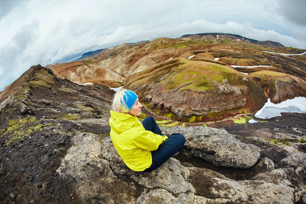
As Iceland’s frozen interior begins to thaw, the country’s best hiking trails slowly start to reveal themselves. From coastal paths to rugged treks, these are the best summer hikes in Iceland.
1. An Easy hike near the coastline in Snaefellsjokull National Park: Arnarstapi – Gatklettur – Hellnar
Located in Iceland’s magical Snaefellsjokull National Park, Arnarstapi is an easy hike that follows the coast and offers beautiful seaside views. This picturesque trail leads hikers from the charming village of Arnarstapi to the quaint town of Hellnar, passing by the stunning natural rock formation known as Gatklettur, an ocean-surrounded arch. This trail is perfect for those looking for a leisurely hike with plenty of scenic photo opportunities and a touch of Icelandic folklore.
Snaefellsjokull National Park, established in 2001, is centered around the Snaefellsjokull volcano, which is capped by a glacier. The park is renowned for its diverse landscapes, which range from black sand beaches and rugged coastlines to lush green fields and dramatic lava formations. The area is steeped in history and legend, with the Snaefellsjokull glacier often linked to mystical stories, including being the entrance to the center of the Earth in Jules Verne’s classic novel.
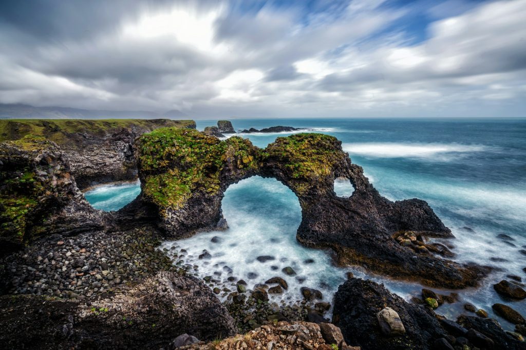
The hike begins in Arnarstapi, a small fishing village known for its charming harbor and striking basalt cliffs. As you start the hike, you’ll encounter Gatklettur, a natural rock arch that stands majestically over the Atlantic Ocean. This geological wonder is a popular spot for photography, offering stunning views as waves crash against the arch.
Continuing along the trail, the path follows the coastline, providing breathtaking views of the ocean and the surrounding landscape. The trail is well-maintained and relatively flat, making it accessible for hikers of all skill levels, including families with children. Along the way, you may encounter various seabirds, including kittiwakes and Arctic terns, which nest along the cliffs.
The hike culminates in the town of Hellnar, another quaint village with a rich history. Hellnar was once one of the largest fishing stations on the Snaefellsnes Peninsula, and today it is known for its scenic beauty and serene atmosphere. The town offers several amenities, including a charming café where you can relax and enjoy local delicacies after your hike.
Trail Route Map
Trail Info
- Difficulty: Easy (1/5)
- Experience: Impressive (5/5)
- Path Conditions: Smooth until reaching the lava field, Good Signage
- Main Challenges: Slick conditions when wet, rocky terrain
- Maximum Ascent: 65 feet (20 meters)
- Distance: 4.3 miles (6.9 kilometers)
- Duration: 45 minutes
How to get there by car
Getting to Arnarstapi Trail from Reykjavik takes 2 hours and 35 minutes. You’ll cover 120 miles along Route 1 and Route 54 to get there (194 kilometers).
2. Best short hike inside Skaftafell Nature Reserve
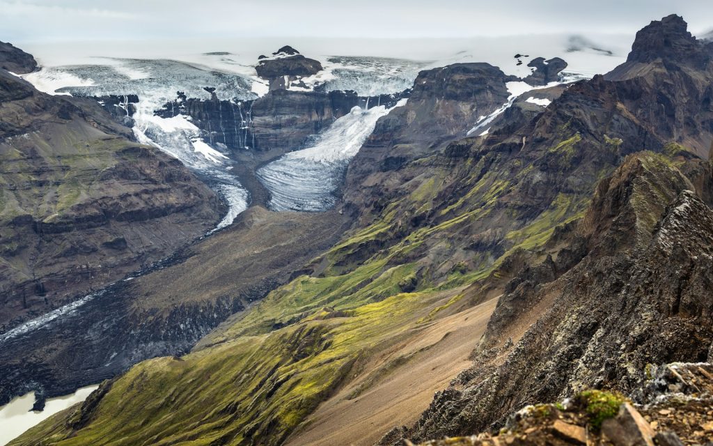
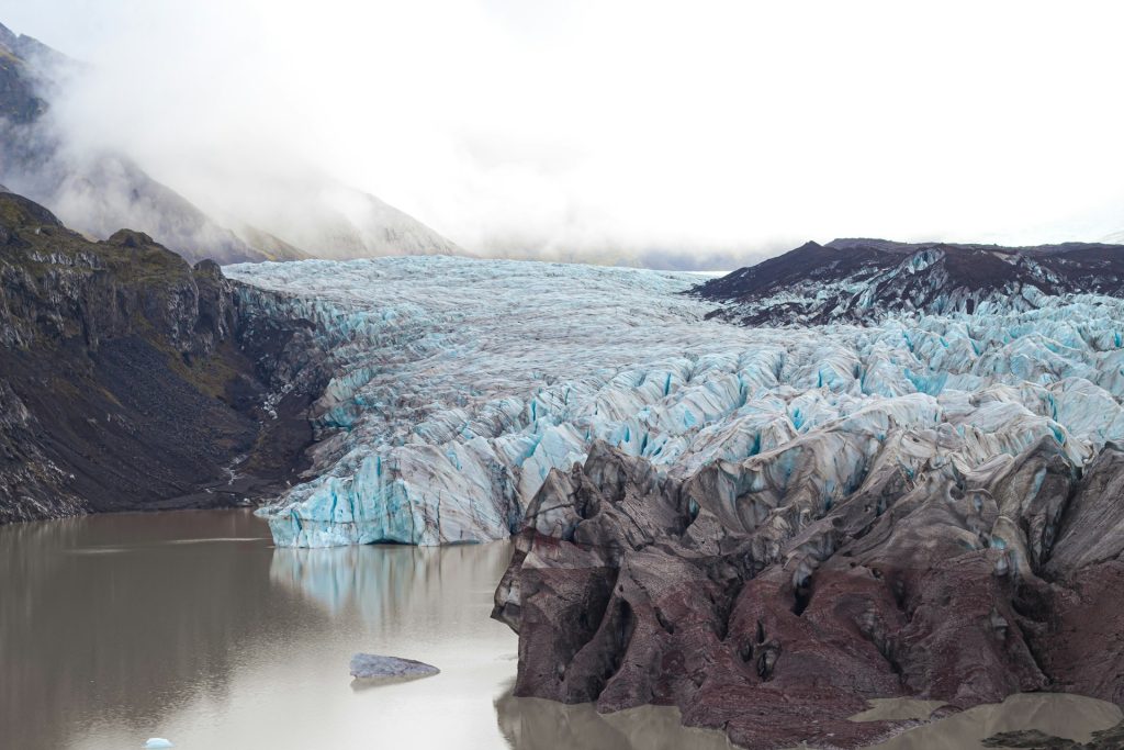
This hike in the Skaftafell Nature Reserve will lead you to mesmerizing waterfalls and panoramic views of the largest glacier in Europe, Vatnajökull Glacier. The trail, known as the Skaftafell Loop, offers a variety of natural attractions and is a favorite among visitors for its accessibility and breathtaking scenery. Because this trail is a loop, you can start or finish with the beautiful Svartifoss Waterfall before continuing on for sprawling views of the ice field from Sjónarnípa Viewpoint and three other waterfall stops.
Skaftafell Nature Reserve is part of Vatnajökull National Park, which encompasses the massive Vatnajökull Glacier and a diverse range of landscapes, from ice caps and volcanoes to lush valleys and waterfalls. The area is rich in geological history and offers a unique blend of fire and ice, where volcanic activity and glacial movements shape the land.
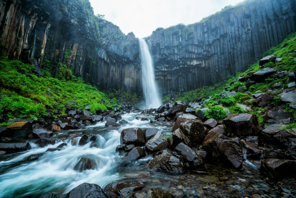
The hike begins at the visitor center, where you can gather information and pick up a trail map. The path to Svartifoss, also known as the “Black Waterfall” due to the dark lava columns that surround it, is a moderate climb but well worth the effort. The waterfall, cascading over a cliff of hexagonal basalt columns, is one of the most photographed sites in Iceland.
Continuing the loop, you will encounter more stunning waterfalls, including Hundafoss and Magnusarfoss, each offering its own unique beauty. The trail then leads to Sjónarnípa Viewpoint, where you are rewarded with expansive views of the Vatnajökull Glacier and the surrounding ice fields. On clear days, the view stretches far into the horizon, offering a glimpse of Iceland’s vast and wild landscape.
Trail Route Map
Trail Info
- Difficulty: Moderate (3/5)
- Experience: Impressive (5/5)
- Path Conditions: Can be muddy after rain, Good Signage
- Main Challenges: Steep climbs and exposed sections of trail, can be crowded around Svartifoss as this is a very popular hike
- Maximum Ascent: 889 feet (271 meters)
- Distance: 4.6 miles (7.4 kilometers)
- Duration: About 2 hours and 15 minutes to complete the loop
How to get there by car
Getting to the Skaftafell Trail from Reykjavik takes 4 hours and 10 minutes. You’ll cover 203 miles (327 kilometers) along Route 1, also known as the Ring Road, to get there.
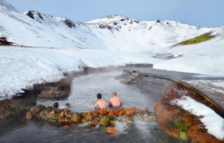
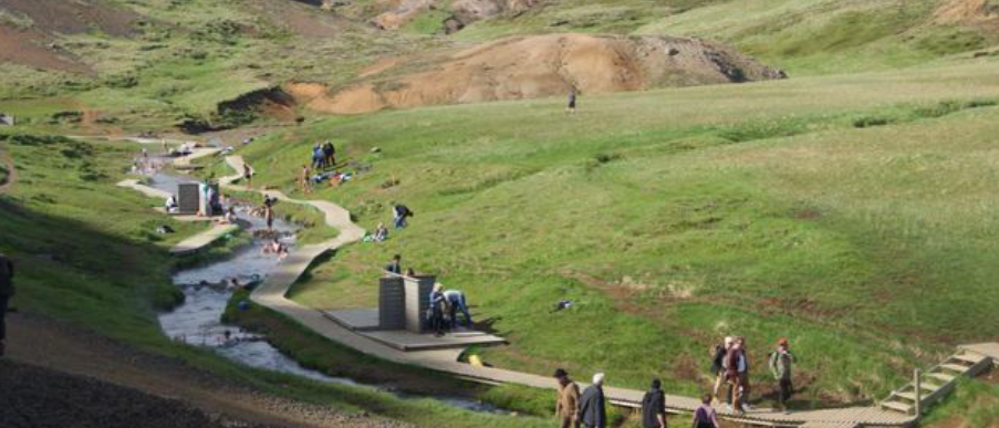
3. Best short hike to a natural hot spring: Hiking to Reykjadalur Hot River Valley
The hike to reach the Reykjadalur hot spring river is well worth the sweat! You’ll trek through winding terrain for 2.8 miles, with views of undulating hills, waterfalls, and steam in the distance, until you reach the geothermally heated river. You’ll find designated changing cabins and raised, wooden trails leading to the soaking areas.
Reykjadalur, which translates to “Steam Valley,” is located near the town of Hveragerði, a region known for its geothermal activity. The hike begins at the outskirts of Hveragerði and quickly transports you into a serene and otherworldly landscape filled with steaming vents, bubbling mud pots, and hot springs. The well-marked trail initially takes you through lush meadows dotted with wildflowers, especially vibrant in the summer months.
As you ascend, the path winds through a series of switchbacks, providing panoramic views of the valley below. Along the way, you’ll pass several small waterfalls, each cascading into crystal-clear pools. The steam rising from the valley adds an ethereal quality to the landscape, making the hike visually stunning and a paradise for photographers.
The trail is moderately challenging, with some steep sections, but it’s suitable for most hikers, including families with older children. The reward at the end of the hike is the Reykjadalur hot spring river, where you can relax and soak in the warm waters. The temperature of the river varies, so you can find a spot that’s just right for you. The wooden walkways and changing cabins ensure that you have a comfortable and convenient experience.
Reykjadalur is also known for its geothermal features, which are not only scenic but also provide insights into the volcanic activity that shapes Iceland. The hike offers an educational experience as well, with information signs along the trail explaining the geology and natural history of the area.
Trail Route Map
Reykjadalur Trail Info
- Difficulty: Moderate (3/5)
- Experience: Impressive (5/5)
- Path Conditions: Muddy when wet, Good signage
- Main Challenges: Paid parking, steep start to the trail
- *There are new changing areas!*
- Maximum Ascent: 1,269 feet (386 meters)
- Distance: 5.7 miles (9 kilometers)
- Duration: About 3 hours with time for soaking in the hot springs
How to get there by car
Getting to the Reykjadalur Trail from Reykjavik takes 48 minutes. You’ll cover 31 miles (50 kilometers) along Route 1, also known as the Ring Road, to get there.
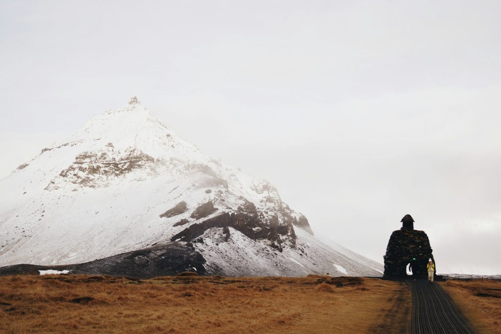
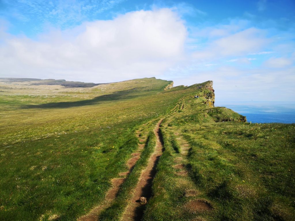
4. Best hike to see Puffins: Látrabjarg Cliff trail
A hiking trail that leads to puffins? Sign us up! The Látrabjarg Cliff Trail is located in Iceland’s rugged Westfjords. This easy trail offers a breathtaking experience as it meanders along sheer cliffs, leading to one of the largest puffin colonies in Iceland. Sweeping landscapes and dramatic cliffs provide an interesting hike along the way, though trekkers need to be extra careful and mind their step.
Látrabjarg is not just a destination for hikers but also a significant bird-watching site. The cliffs stretch for 14 kilometers and stand up to 440 meters tall, providing a perfect nesting ground for millions of seabirds, including puffins, razorbills, guillemots, and fulmars. These cliffs are one of the westernmost points of Europe and are crucial for bird conservation, being home to nearly half of the world’s razorbill population.
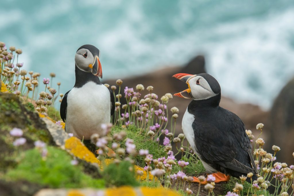
The puffins, with their colorful beaks and charming demeanor, are a major attraction at Látrabjarg. They typically nest in burrows along the cliff edges, and the best time to see these delightful birds is from May to mid-August, with June and July being peak months. During this period, the puffins are busy feeding their chicks and can often be seen flying back and forth with beaks full of fish.
While the trail itself is relatively easy, the cliffs are extremely steep and exposed, requiring hikers to exercise caution, especially in windy conditions. The terrain is generally smooth, but the edge of the cliffs can be unstable, so it’s important to stay on marked paths and not venture too close to the edge.
Trail Route Map
Látrabjarg Trail Info
- Difficulty: Easy (1/5)
- Experience: Impressive (5/5)
- Path Conditions: Smooth terrain, Good signage
- Main Challenges: Exposed, sheer cliffs that are dangerous and high winds
- Maximum Ascent: 2,880 feet (877 meters)
- Distance: 4.5 miles (7.2 kilometers)
- Duration: About 4 hours
How to get there by car
Getting to the Latrabjarg Cliff Trail from Reykjavik takes 5 hours and 48 minutes. You’ll cover 258 miles (415 kilometers) along several different roads, including Route 1, to get there.
Vatnajökull National Park Hike to Skógafoss Waterfall Trail
The Vatnajökull National Park hike to Skógafoss Waterfall is an extraordinary journey through one of Iceland’s most diverse and breathtaking landscapes. This trail offers hikers a unique opportunity to experience the park’s varied terrain, from glacial rivers and lush green valleys to rugged volcanic formations.
The Skógafoss Waterfall, with its impressive 200-foot drop, serves as a stunning focal point of this hike. As the trail follows the Skógá River upstream, it reveals 26 other magnificent waterfalls, making it a visual feast for nature enthusiasts.
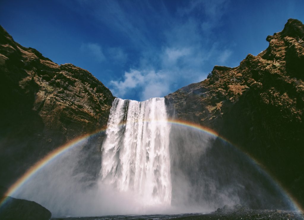
Starting from the park’s entrance, hikers will immediately be captivated by the powerful and picturesque Skógafoss. The trail continues to climb, presenting panoramic views of the surrounding landscapes, including views of Iceland’s highest peak, Hvannadalshnúkur, which towers over the Vatnajökull glacier. This peak, standing at 2,110 meters (6,923 feet), adds a dramatic backdrop to the already stunning scenery.
The trail is part of the larger Fimmvörðuháls hike, which connects with the Þórsmörk valley, offering adventurous hikers an extended route through Iceland’s highlands. Along the way, hikers can explore volcanic craters, witness the steam vents of geothermal areas, and enjoy the serene beauty of moss-covered canyons.
Trail Route Map
Trail Info
- Difficulty: Moderate (3/5)
- Experience: Awe-inspiring (5/5)
- Path Conditions: Well-maintained with good signage, though can be slippery near the waterfall.
- Main Challenges: Steep inclines, particularly the climb next to Skógafoss, and potentially muddy conditions.
- Maximum Ascent: Approximately 500 meters (1,640 feet)
- Distance: 16 kilometers (10 miles) round trip
- Duration: 4 to 6 hours
How to Get There by Car: From Reykjavik, take Route 1 southeast for about 2 hours (155 kilometers) until you reach Route 249. Turn onto Route 249 towards Skógar, where ample parking is available near the waterfall.
Additional Information: Vatnajökull National Park, the largest national park in Europe, is home to a diverse array of landscapes, from towering glaciers to expansive volcanic deserts. The hike to Skógafoss is particularly notable for its rich history and geological features.
The trail follows the Skógá River, which originates from the Eyjafjallajökull and Mýrdalsjökull glaciers, passing 26 other stunning waterfalls. This hike is part of the larger Fimmvörðuháls trail, which extends into the highlands, offering adventurous hikers the opportunity to explore even more remote and beautiful parts of Iceland.
The Skógafoss area itself is steeped in local folklore, with legends of hidden treasures buried by the first Viking settlers, adding an element of mystery and intrigue to your hike.
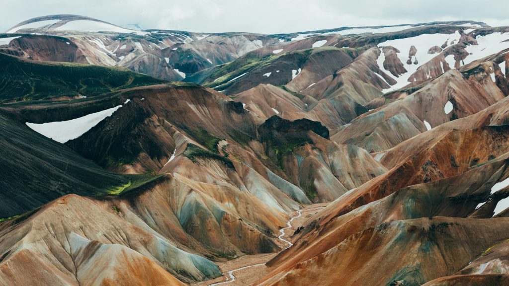
6. Laugavegur Trail: Iceland’s Premier Long-Distance Hike
Location: Southern Highlands of Iceland, starting from Landmannalaugar to Þórsmörk
The Laugavegur Trail is Iceland’s most famous multi-day trek, renowned for its stunning and diverse landscapes. Starting in the geothermal paradise of Landmannalaugar, the trail takes hikers through a series of remarkable natural wonders.
The journey begins with colorful rhyolite mountains, characterized by their vibrant hues and steam vents that hint at the geothermal activity beneath. As hikers progress, they encounter a variety of terrains, including expansive lava fields, lush valleys, and black sand deserts.
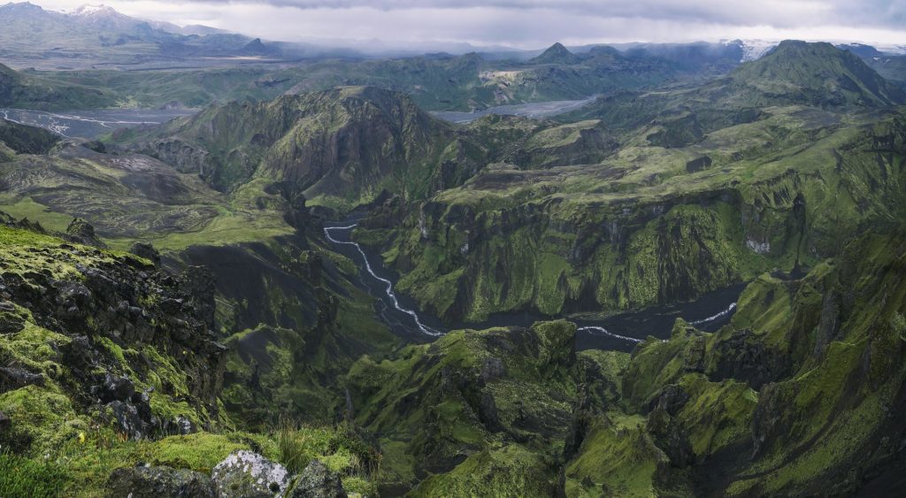
One of the highlights of the Laugavegur Trail is the opportunity to explore volcanic craters and blue peaks that rise dramatically against the backdrop of Iceland’s raw and untamed beauty. The trail also passes by natural hot springs, offering a perfect spot to relax and soak in the warm waters after a day of hiking.
The Laugavegur Trail is well-marked, but for those seeking a more enriched experience, guided hiking tours are available. These tours are led by knowledgeable local guides who can provide insights into the geology, flora, and fauna of the region, as well as the cultural history of Iceland. Whether you choose to hike independently or with a guide, the trail promises an unforgettable adventure through some of Iceland’s most breathtaking landscapes.
Trail Route Map
Trail Info:
- Difficulty: Challenging (4/5)
- Experience: Spectacular (5/5)
- Path Conditions: The trail is well-marked but includes rough and varied terrain. Weather conditions can change rapidly.
- Main Challenges: The trail features significant elevation changes and potentially harsh weather conditions. River crossings and steep ascents are part of the challenge.
- Maximum Ascent: Around 500 meters (1,640 feet)
- Distance: 55 kilometers (34 miles)
- Duration: Typically takes 3 to 4 days to complete, depending on pace and weather.
How to Get There by Car: To reach Landmannalaugar from Reykjavik, drive via Route 1 towards the town of Hella. From Hella, take Route 26 and then Route F208, following signs to Landmannalaugar. The drive is approximately 3 to 4 hours (around 180 kilometers). Note that the final stretch involves highland roads, which may require a 4×4 vehicle.
How to pack and prepare for the hikes?
Preparing for a hike in Iceland involves careful planning and packing to ensure a safe and enjoyable experience. The country’s unique and unpredictable weather conditions, combined with its diverse terrain, require hikers to be well-prepared. Here are some detailed tips and information on how to pack and prepare for the best hikes in Iceland:
Weather Check
- Monitor the Weather: Always check the Icelandic MET Office website (vedur.is) for accurate and up-to-date weather conditions. Iceland’s weather can change rapidly, even in summer, and being aware of the forecast is crucial for planning your hike.
- Local Updates: Pay attention to local weather advisories and road conditions. Websites like SafeTravel Iceland (safetravel.is) provide important safety information and travel alerts.
Clothing and Gear
- Layering System: Dress in layers to adapt to changing weather conditions. Start with a moisture-wicking base layer, add an insulating layer (like fleece or down), and top it off with a waterproof and windproof outer layer.
- Warm Accessories: Even in summer, temperatures can dip below freezing. Pack a winter hat, gloves, and a scarf to keep warm.
- Sturdy Footwear: Hiking boots are essential for Iceland’s often slippery and uneven trails. Ensure your boots are waterproof and well-broken-in to avoid blisters.
- Socks and Gaiters: Wear moisture-wicking hiking socks and consider gaiters to keep your feet dry and protect them from debris.
- Rain Gear: A good quality rain jacket and rain pants are indispensable, as Icelandic weather can be very wet.
- Sunglasses and Sunscreen: The summer sun can be intense despite mild temperatures. Protect your eyes with UV-blocking sunglasses and your skin with a high-SPF sunscreen.
Essentials for the Hike
- Backpack: A sturdy, comfortable backpack is necessary to carry your gear. Look for one with a rain cover and multiple compartments for organization.
- Water and Hydration: Bring plenty of water, and consider a hydration system for easy access. Icelandic water is very clean, so you can refill from streams in many areas.
- Food and Snacks: Pack high-energy snacks like nuts, dried fruit, and energy bars. For longer hikes, bring a packed lunch.
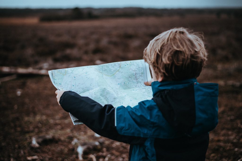
- Navigation Tools: Carry a map, compass, and/or GPS device. While many trails are well-marked, having these tools can help if you stray off the path or need to navigate in poor visibility.
- Safety Gear: A first aid kit, whistle, and emergency blanket are crucial for unexpected situations. Consider bringing a multi-tool or knife as well.
- Mobile Phone: Ensure your phone is fully charged and consider carrying a portable charger. Having a phone is important for emergency communication.
Safety Precautions
- Inform Others: Always inform someone about your hiking plans, including your route and expected return time. This is vital in case of emergencies.
- Stay on Trails: Stick to marked trails to protect the environment and for your safety. Off-trail hiking can be dangerous due to unstable terrain and hidden hazards.
- Check Local Advice: Some areas may have specific safety advisories or restrictions, especially in more remote or ecologically sensitive regions. Check with local visitor centers or park rangers.
Additional Tips
- Acclimate to Conditions: Spend some time getting used to the local weather and terrain before embarking on longer hikes. Shorter hikes can help you acclimate.
- Respect Nature: Iceland’s landscapes are fragile. Follow Leave No Trace principles: pack out all trash, avoid disturbing wildlife, and respect plant life.
- Prepare for Emergencies: Know basic first aid and how to handle common hiking injuries. Familiarize yourself with emergency procedures and local emergency numbers.
Tips for getting ready for a trip to Iceland in summer
● Book Early – Making sure to book your summer vacation in Iceland early is one of the most important tips! You’ll need to book rental cars, accommodation, and activities at least 3 months in advance to ensure that you get what you’re looking for.
● Be Prepared for Bad Weather – Bad weather can strike Iceland at any time of year. While it might not be snowing or icing, temperatures can quickly turn chilly and even freeze at higher elevations. Rain is also common in Iceland in the summer months. Be sure to check the weather before you head out!
● Plan in Advance – Because you’ll be booking your trip early, you should also start planning early. Some areas of Iceland are only accessible during the summer months like the rugged interior highlands, Landmannalaugar and Iceland’s many mountains! Check our guides to Iceland in July and Iceland in August to prepare for what to expect.
Conclusion
The best time of year to hike Iceland’s trails is in the summer months.
Check out Firefly Iceland Car Rentals to find some of the cheapest car rentals in the country and get started planning your epic hiking adventures in Iceland!
Share this post with your friends to help inspire their own trip. Who knows, maybe they’ll join you in the Land of Fire and Ice.